Garmin Oregon N00/N00t/N50/N50t


O último grito em tecnologia... Novos Firmwares...

Moderadores: hulkman, migueis

Geopt Proud Member
Geopt Proud Member

Mensagens: 29303

Registado: segunda 15 mar 2010, 20:20

Mensagem Post: #11 a terça 08 jan 2013, 17:54 

Re: [Novo] Garmin Oregon 600/600t/650/650t

Imagem Imagem Imagem Imagem
Avatar do Utilizador

Geocacher Muito Viciado

Mensagens: 2247

Registado: quinta 05 mai 2011, 10:44

Localização: Alcanena

Mensagem Post: #12 a terça 08 jan 2013, 20:18 

Re: [Novo] Garmin Oregon 600/600t/650/650t

parece e que estes vao ter a funcionalidade nuvi como os montana.

Small
Small

Mensagens: 36

Registado: segunda 27 set 2010, 23:31

Mensagem Post: #13 a sexta 11 jan 2013, 02:06 

Re: [Novo] Garmin Oregon 600/600t/650/650t

com o lançamento destes novos garmin, a serie dakota ou etrex irão baixar de preço?

É que eu ando para comprar um gps entre o dakota 20, etrex 20,30 mas os preços são um pouco altos..

E os gps mais antigos usados pedem o mesmo por um recente..

Geopt Proud Member
Geopt Proud Member

Mensagens: 29303

Registado: segunda 15 mar 2010, 20:20

Mensagem Post: #14 a sexta 11 jan 2013, 15:51 

Re: [Novo] Garmin Oregon 600/600t/650/650t

É bastante provável que os preços das séries mais antigas venham a desvalorizar, sobretudo no mercado da segunda mão, pois haverá muita gente a desfazer-se desses equipamentos para adqurir estes novos modelos.
Imagem Imagem Imagem Imagem
Avatar do Utilizador

Geocoin
Geocoin

Mensagens: 838

Registado: segunda 07 fev 2011, 19:44

Mensagem Post: #15 a sexta 11 jan 2013, 16:24 

Re: [Novo] Garmin Oregon 600/600t/650/650t

Essa baixa de preços, já se está a fazer sentir. Não sei se tem relação direta com a futura comercialização destes novos modelos.

Temos um Oregon 450, está a fazer em Fevereiro, 2 anos. Na altura custou-nos 340€ e agora o mesmo modelo está por 259€
Imagem Imagem Imagem
Avatar do Utilizador

Geocoin
Geocoin

Mensagens: 602

Registado: segunda 05 abr 2010, 21:58

Localização: Porto

Mensagem Post: #16 a sexta 11 jan 2013, 16:29 

Re: [Novo] Garmin Oregon 600/600t/650/650t

bodi.bifes Escreveu:Essa baixa de preços, já se está a fazer sentir. Não sei se tem relação direta com a futura comercialização destes novos modelos.

Temos um Oregon 450, está a fazer em Fevereiro, 2 anos. Na altura custou-nos 340€ e agora o mesmo modelo está por 259€


Excelente noticia,


Sent from my iPhone!
The Chase Is Better Then The Catch!
Imagem


Imagem
Avatar do Utilizador

Geocacher Muito Viciado

Mensagens: 2247

Registado: quinta 05 mai 2011, 10:44

Localização: Alcanena

Mensagem Post: #17 a sexta 11 jan 2013, 16:41 

Re: [Novo] Garmin Oregon 600/600t/650/650t

por ter visto essa baixa nos oregons é que vendi o meu etrex 30.

apesar de ambos serem muitos bons e terem pontos fortes distintos é uma diferença abismal.
Avatar do Utilizador

Geopt Proud Member
Geopt Proud Member

Mensagens: 10775

Registado: domingo 25 abr 2010, 09:08

Localização: Portugal

Mensagem Post: #18 a quinta 21 mar 2013, 16:38 

Re: [Novo] Garmin Oregon 600/600t/650/650t

OVERVIEW

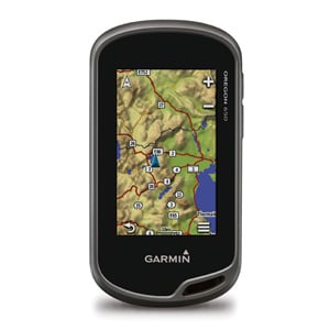
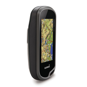
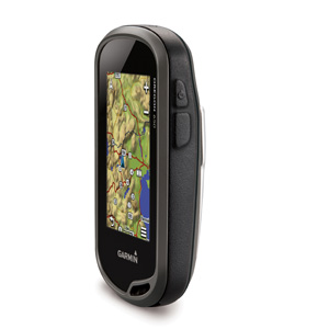
With high-sensitivity GPS and GLONASS satellite tracking, worldwide basemap with shaded relief and customizable buttons for 1-touch image capture and waypoint marking, Oregon 650 opens a new world of GPS mapping and positioning.


Quality Photos

Take quality photos with Oregon 650's built-in 8 MP autofocus digital camera.
Each photo is geotagged, allowing you to navigate back to that exact spot.
Share the photos with all your friends through Garmin Adventures.
For more storage, insert a microSD™ card; you can even view pictures from other devices on microSD card with Oregon's picture viewer.


Touch and Go

Oregon 650 has reflective display technology for the most brilliant, sunlight readable touchscreen we’ve ever made.
It's as vivid in full bright sunlight as it is in shade.
The screen has been strengthened for impact resistance but still accommodates gloved operation.
And with dual-orientation, multi-touch screen, you won’t just look at maps, you’ll interact with them when you zoom in, pan out and rotate the display.


Double Your Power

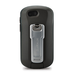
Oregon 650 features our state-of-the-art dual battery system.
You’ll have the option of using the internally rechargeable NiMH pack (included) or traditional AA batteries — NiMH pack charges when the device is connected to external power.


Get Your Bearings

Oregon 650 has a built-in 3-axis electronic compass with accelerometer tilt compensation to show where you're heading even when standing still, or not holding it level.
Its barometric altimeter tracks changes in pressure to pinpoint your precise altitude.
You can even use it to plot barometric pressure over time to keep an eye on changing weather conditions.

With its high-sensitivity, WAAS- and GLONASS-enabled GPS receiver and HotFix® satellite prediction, Oregon 650 locates your position quickly and precisely, and maintains its GPS location even in heavy cover and deep canyons.


Share Wirelessly

With Oregon 650 you can share your waypoints, tracks, routes and geocaches up to 50 times faster with other wireless compatible Garmin handheld devices. Plus, you can share large files too like photos, Garmin Adventures and Custom Maps.
Just touch “send” to transfer your information.


Add Maps

Adding more maps to Oregon is easy.
Load TOPO U.S. 24K maps and hit the trail; add Trailhead Series TOPO maps and explore famous treks like the Appalachian Trail and the Pacific Crest Trail; plug in BlueChart® g2 preloaded cards for a great day on the water; or load City Navigator® map data for turn-by-turn routing on roads.
Add satellite images to your maps with BirdsEye Satellite Imagery (subscription required).


Load All the Geocaches

No more picking, choosing and planning, just download them all.
The Oregon 650 can hold up to 4 million.
Download every cache on OpenCaching.com.
Load caches from GSAK.
Or use your favorite program or website supporting GGZ files.
All your paperless geocaching features will be there for every cache.
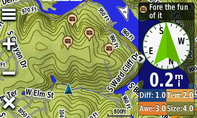
Read full descriptions, hints and logs. View cache photos.
Filter caches by size, terrain, difficulty and type. Connect to chirp-enabled caches. Record your logs in the field.
Do it all.


Plan Your Next Trip

Take charge of your next adventure with BaseCamp™, software that lets you view and organize maps, waypoints, routes and tracks.
This free trip-planning software even allows you to create Garmin Adventures that you can share with friends, family or fellow explorers.
BaseCamp displays topographic map data in 2-D or 3-D on your computer screen, including contour lines and elevation profiles.
It also can transfer an unlimited amount of satellite images to your device when paired with a BirdsEye Satellite Imagery subscription.

Source: https://buy.garmin.com/shop/shop.do?cID=145&pID=113520
It's not always the find that brings the smiley... Imagem
It's not about the number you've found.
It's about the fun you had along the way.

The only numbers that matter are the friends you make!
It's all about the journey, the challenge, and enjoying the outdoors!
Avatar do Utilizador

Geopt Proud Member
Geopt Proud Member

Mensagens: 10775

Registado: domingo 25 abr 2010, 09:08

Localização: Portugal

Mensagem Post: #19 a quinta 21 mar 2013, 16:44 

Re: [Novo] Garmin Oregon 600/600t/650/650t

It's not always the find that brings the smiley... Imagem
It's not about the number you've found.
It's about the fun you had along the way.

The only numbers that matter are the friends you make!
It's all about the journey, the challenge, and enjoying the outdoors!
Avatar do Utilizador

Geopt Proud Member
Geopt Proud Member

Mensagens: 10775

Registado: domingo 25 abr 2010, 09:08

Localização: Portugal

Mensagem Post: #20 a quinta 21 mar 2013, 16:52 

Re: [Novo] Garmin Oregon 600/600t/650/650t

FEATURES :

Display Brightness
Reflective display technology uses external light, such as sunlight, in combination with the device’s LED backlight to increase brightness and viewing.
Plus, you conserve power by not having to turn the backlight up.

Imagem


Dual Orientation
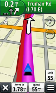
View maps and data in portrait or landscape mode.
Landscape mode is great for typing and road navigation.

Imagem

Imagem


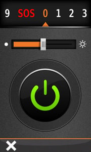
Flashlight
Torch has high and low brightness levels and strobe options to conserve battery power.

Imagem


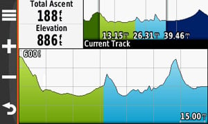
Advanced Elevation Plot
Full Track view lets you see the entire elevation plot and quickly move your zoomed view to any place on the plot.
Future Plot uses your mapping data to show what to expect ahead.

Imagem


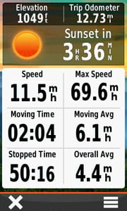
Improved Trip Computer
Get 33 percent more data on screen at once with new layout options.
Add multiple pages of data fields, each customizable to 1 of 4 layouts: 2 large, 1 large and 4 small, 6 small or 8 small.

Imagem


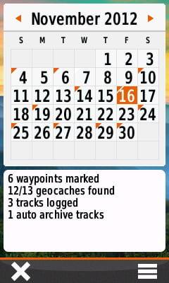
Activity Tracking (Calendar)
Track your accumulated activities, waypoints and geocaches; tracks on the day you do them.

Imagem


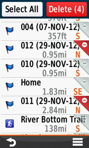
Advanced Waypoint Management
All data is displayed and editable on 1 screen.
Delete 1 or multiple waypoints at a time from the Waypoint Manager menu.

Imagem


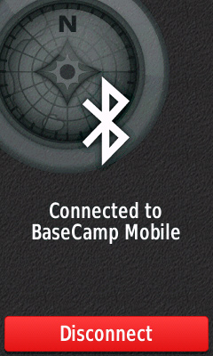
Wireless Capable: Bluetooth® and ANT
Now you can wirelessly transfer large files such as photos, geocaches, adventures, routes and Custom Maps between Oregon 600-series devices (or with Garmin Basecamp Mobile).
Plus, new technology allows your routes, waypoints and tracks to transfer up to 50 times faster.
Oregon is also ANT+ wireless compatible for heart rate, cadence, chirp™ and tempe™ sensors.

Imagem


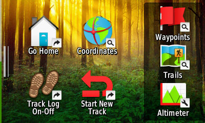
Shortcuts
Launch apps, switch Profiles, apply settings and start navigating with 1 touch.

Imagem


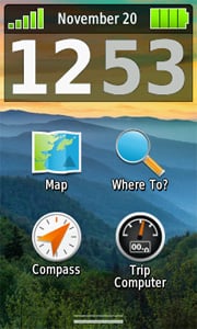
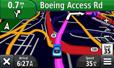
Dashboards/nüvi® Mode
Dashboards let you hide and show more functions to your favorite app.
With this at-a-glance information, you can multi-task without having to disable the app.

Imagem

Source: https://buy.garmin.com/shop/shop.do?cID=145&pID=113520
It's not always the find that brings the smiley... Imagem
It's not about the number you've found.
It's about the fun you had along the way.

The only numbers that matter are the friends you make!
It's all about the journey, the challenge, and enjoying the outdoors!
AnteriorPróximo

Voltar para GADGETS & GIZMOS

Quem está ligado:

Utilizadores a ver este Fórum: Nenhum utilizador registado e 2 visitantes

Powered by PHPBB - Geopt.org 2013